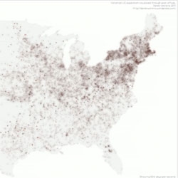
Derek Watkins' posted: Visualizing US expansion through post offices from 1700 to 1900.
August 11th, 2011
Created using data from the USPS Postmaster Finder with lat/long coordinates extracted from placenames through correlation with the USGS Geographic Names Information System.
More on the project here.

Copyright NOTCOT INC 2005-2024 - Privacy Policy